Address
304 North Cardinal St.
Dorchester Center, MA 02124
Work Hours
Monday to Friday: 7AM - 7PM
Weekend: 10AM - 5PM

Address
304 North Cardinal St.
Dorchester Center, MA 02124
Work Hours
Monday to Friday: 7AM - 7PM
Weekend: 10AM - 5PM
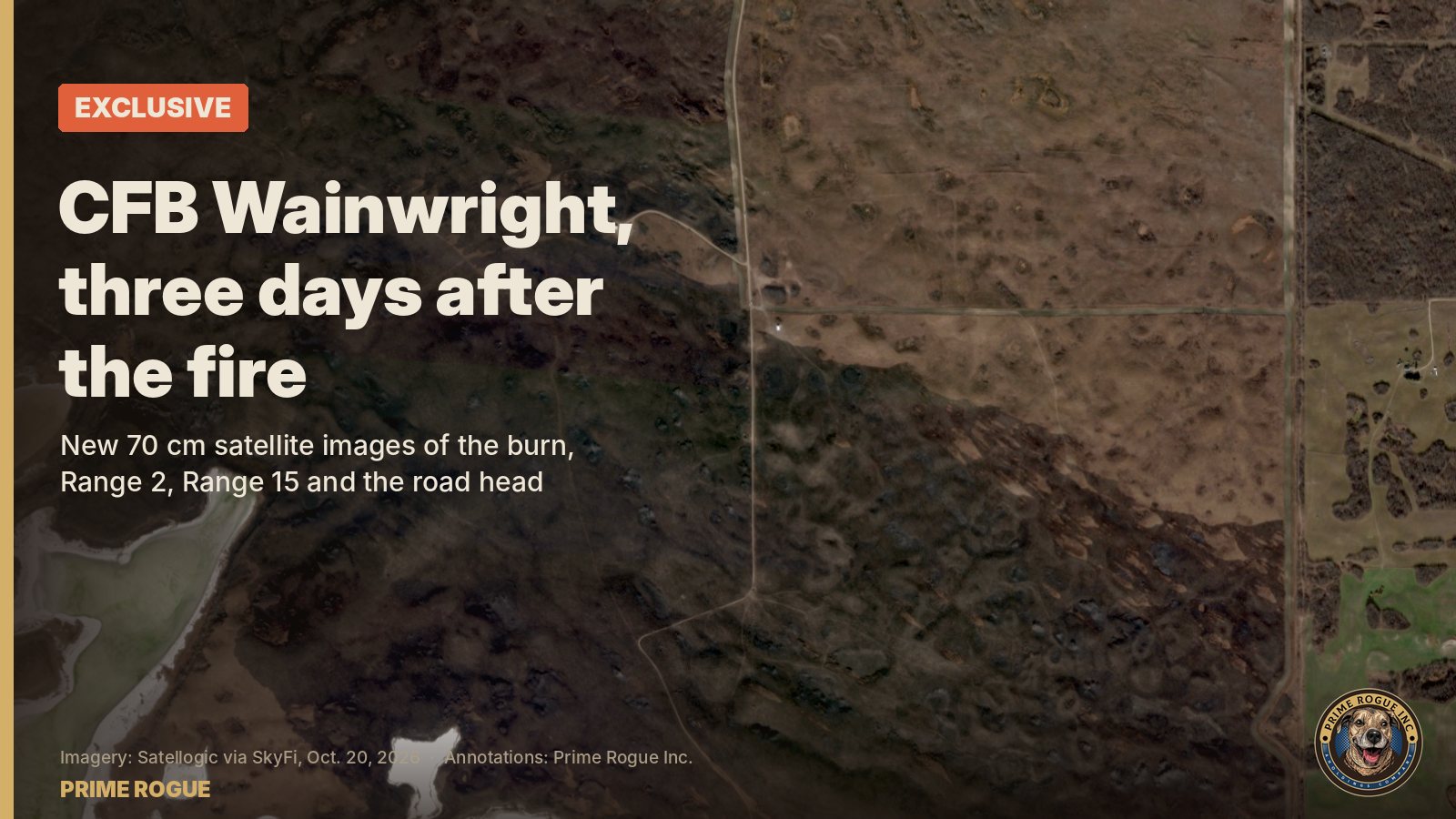
These CFB Wainwright fire satellite images were taken at 12:56 p.m. on Oct. 20, 2026, by a Satellogic satellite, and licensed by Prime Rogue. At 70 cm per pixel, they show tracks, pads and patches of unburned grass that earlier public images could not. CBC published wider Planet Labs images of the burn on Oct. 20. These are the first published at sub-metre resolution to show Range 2 and Range 15, the likely pairs range, up close.
The fire burned about 1,150 hectares. Most of it went in one run after a cold front reached it around 3:29 p.m.; we traced how in the flank became the front. Satellites had seen the fire hours before DND’s ignition time. DND has said the fire reached the pairs range “just before 4:00. Follow every update on our CFB Wainwright fire live page.
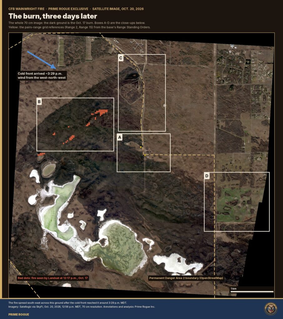
The dark ground is the Oct. 17 burn. Red dots are where Landsat saw fire at 12:17 p.m., three hours before the run. Yellow dots are Range 2 and Range 15, plotted from the grid references in the base’s 2024 Range Standing Orders, first reported by Global News’ Ashleigh Stewart. Boxes A to D are the close-ups below.
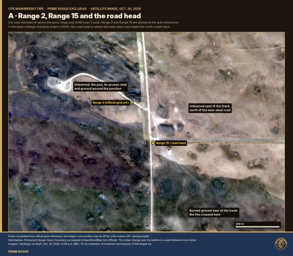
DND hasn’t said where the pairs range was. Our analysis places it here: Range 15 is a field-firing range, the kind used for fire-and-movement in pairs, and DND’s “a kilometre away” fits this ground best. Range 2 sits on an unburned strip beside a gravel pad and its access road. Range 15 and the road head sit at the junction of the east-west road and the north-south track, also on unburned ground. The fire burned all around them and crossed the track just south of the junction. North of the east-west road, the ground east of the track did not burn.
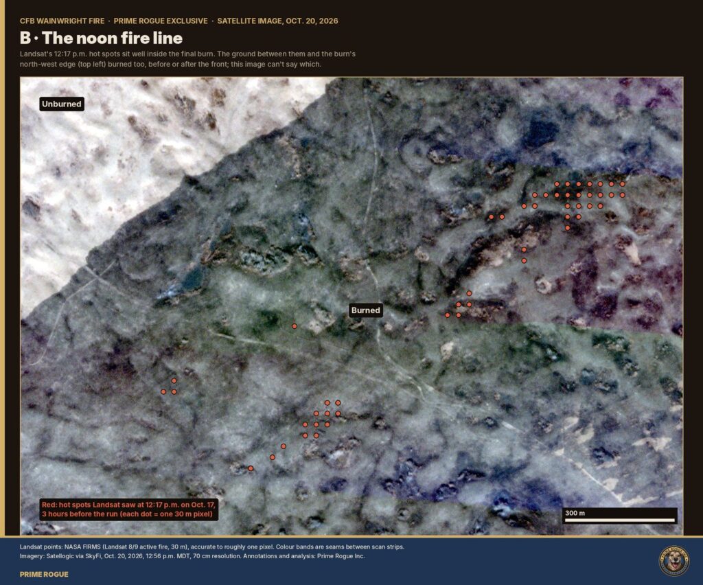
Landsat’s 12:17 p.m. hot spots sit well inside the final burn. The ground between them and the burn’s north-west edge burned too, before or after the front; this image cannot say which. Before the front, the fire crept; after it, the wind drove it south-east.
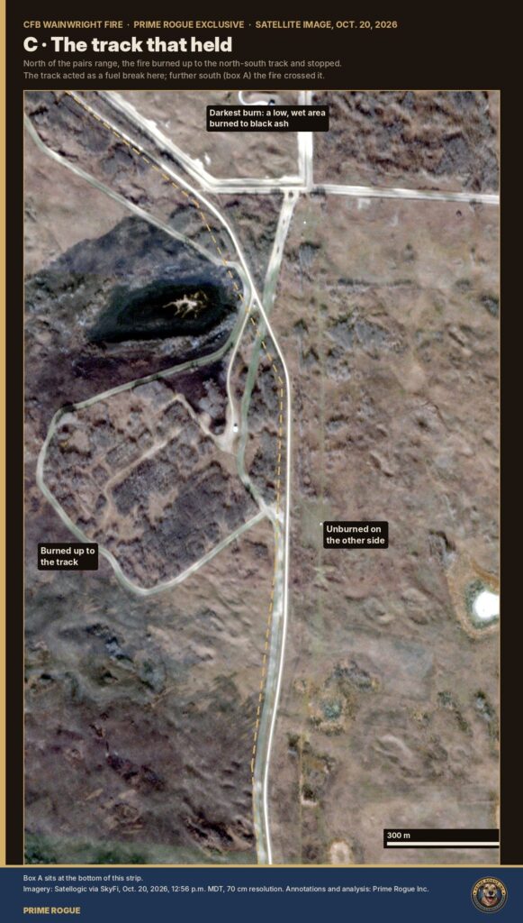
North of the pairs range, the fire burned up to the north-south track and stopped. The track worked as a fuel break here. Further south, at the pairs range, the fire crossed it, and Canadian soldiers died, and suffered horrific injuries as a result.
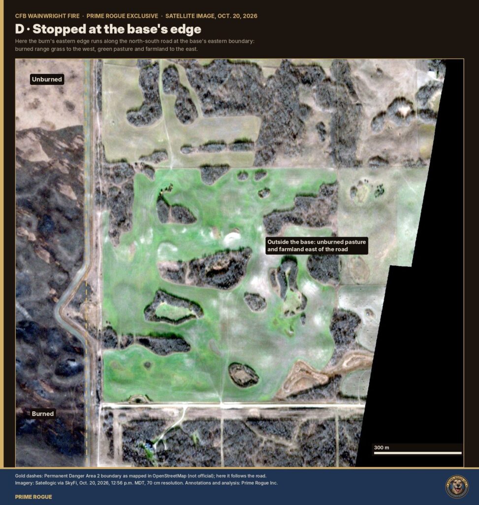
On the east side, the burn runs up to the road on the base’s eastern boundary. Burned range grass lies to the west; green pasture and farmland lie to the east.
The image is Satellogic NewSat-49, 18:56 UTC Oct. 20, 70 cm resolution, bought through SkyFi. The range locations come from the base’s Range Standing Orders, not from maps; Global News first reported the orders, via investigative journalist Ashleigh Steward, including their advice to fire early in the day in October. The satellite looked 24° off straight down, so positions may be off by a few metres. The danger-area line is OpenStreetMap’s, not official. Our data, code and methods are in the CFB Wainwright fire archive.
Imagery: Satellogic via SkyFi, Oct. 20, 2026. Annotations and analysis: Prime Rogue Inc. These images are licensed to Prime Rogue and are not available for download.
 Another sign pointing away from gas: what satellites and the regulator show about CFB Wainwright’s gas lines
 The Noon Photograph: What Landsat Shows About Where The CFB Wainwright Fire Started, and The Gas Lines It Crossed
 LIVE: CFB Wainwright Fire: What The Data and Records Show About the Blaze that Killed Four Soldiers
 Satellites saw fire on CFB Wainwright range hours before DND says it ignited


[…] in the United States. It is not publicly known whether the State Department gave its staff in Canada any comparable guidance during Alberta’s […]
[…] order and announcement; NOAA GOES-18 ABI; Copernicus Sentinel-2 and Sentinel-5P; NASA FIRMS; Environment and Climate Change Canada station CZWN; Global News; the Canadian Press; Sumerian Oil & Gas. The fire’s start and […]
[…] reading is the wind at the top of the hour, averaged over two minutes. This is what goes into Environment Canada’s historical hourly tables. It is a snapshot, so it misses anything that happens between […]
[…] between DND/CAF personnel and outside agencies, including Alberta Health Services EMS, STARS, Alberta Wildfire, the RCMP, and municipal fire […]
[…] bright, lumpy band is the storm line: the “line of showers and weak thunderstorms” that Environment Canada warned at 2:14 p.m. was moving east, with gusts up to 100 […]