Address
304 North Cardinal St.
Dorchester Center, MA 02124
Work Hours
Monday to Friday: 7AM - 7PM
Weekend: 10AM - 5PM

Address
304 North Cardinal St.
Dorchester Center, MA 02124
Work Hours
Monday to Friday: 7AM - 7PM
Weekend: 10AM - 5PM
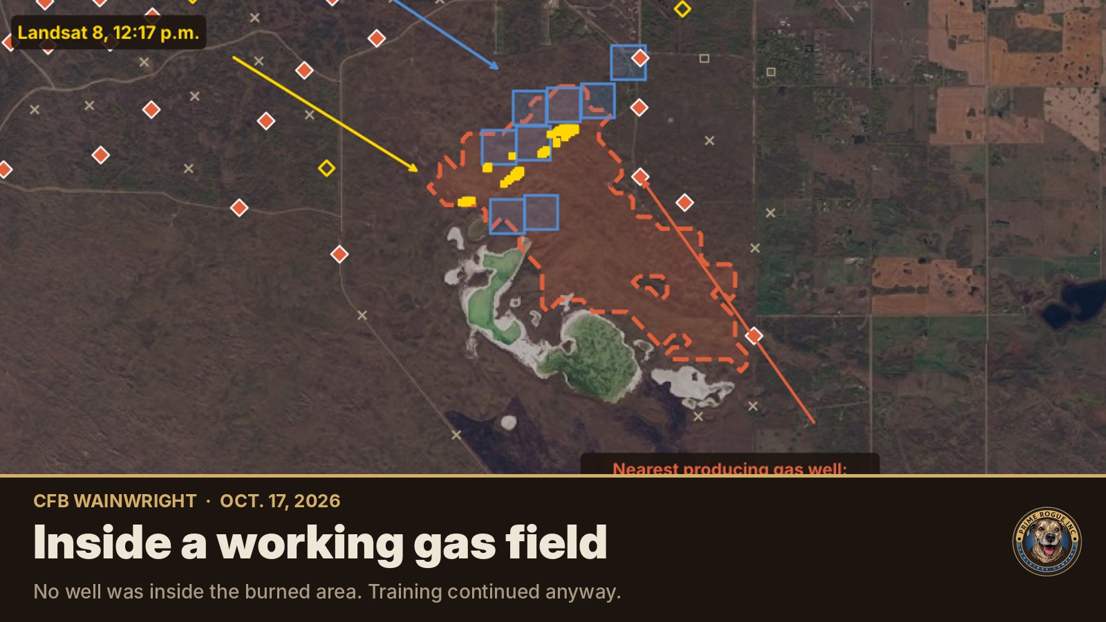
Early reports and posts online suggested a gas well or gas line was involved in the fire that killed four Canadian soldiers at CFB Wainwright on Oct. 17. The public records say otherwise.
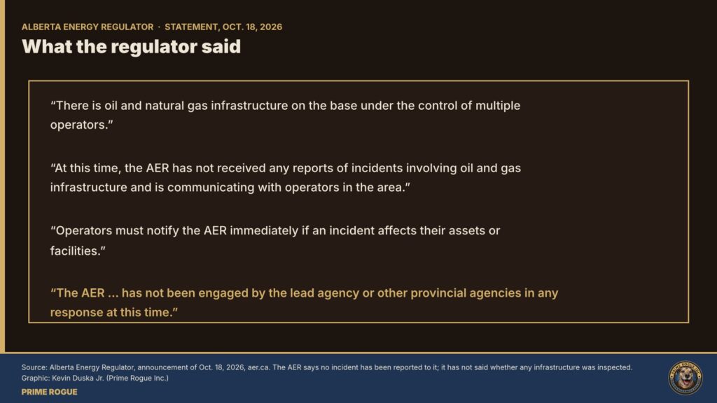
The Alberta Energy Regulator (AER), which oversees oil and gas wells in the province, said in a that there is “oil and natural gas infrastructure on the base under the control of multiple operators.” It said it “has not received any reports of incidents involving oil and gas infrastructure” and is in contact with operators in the area. Operators must notify the regulator immediately if an incident affects their assets.
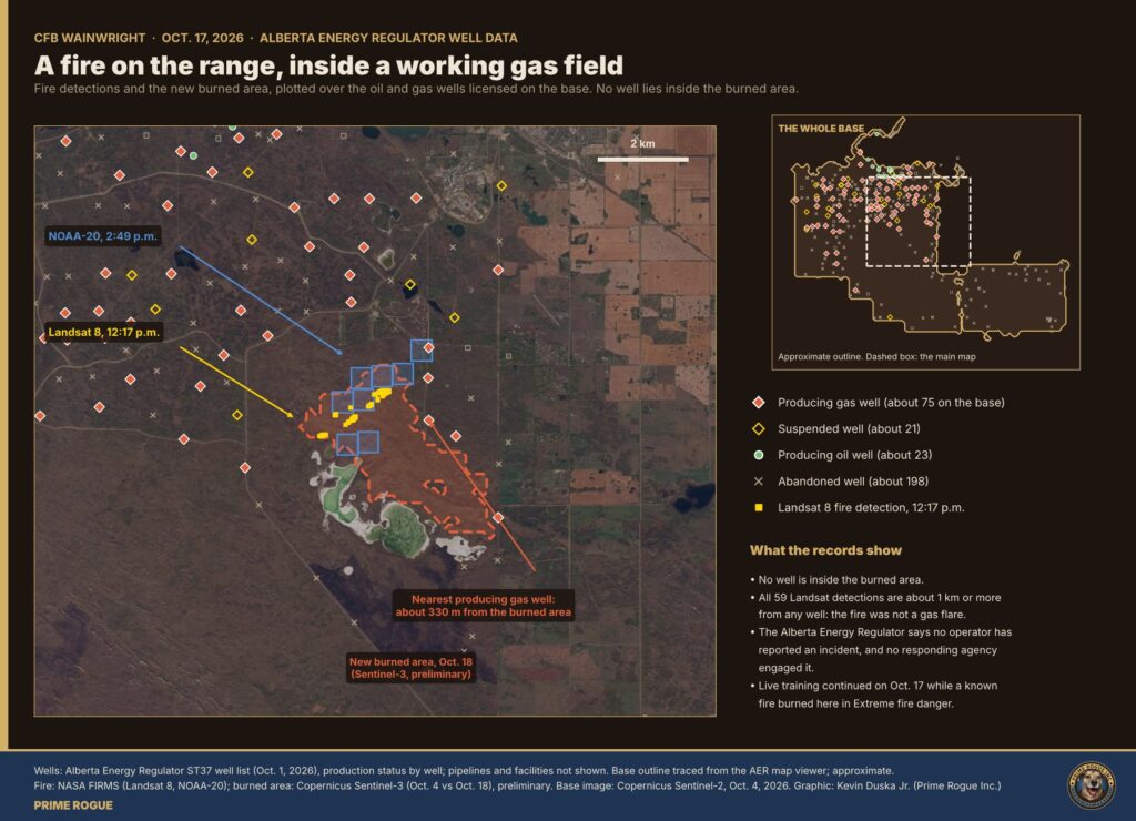
Prime Rogue mapped the AER’s public well list against the fire detections and the area that burned.
Wells on the training area are completed below ground level, with buried pipelines, so a grass fire passing over them would not reach them, a source with knowledge of the sector confirmed to Prime Rogue.
Gas wells can produce false fire alarms from space. Flares and heaters at well sites are hot enough for satellites to flag as fire.
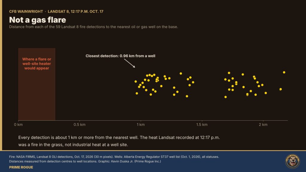
That makes the well map a useful check on the most important record of Oct. 17: NASA’s Landsat 8 detection of fire on the range at 12:17 p.m., nearly four hours before the time National Defence gives for the fire. All 59 points Landsat flagged are about 1 km or more from any well, oil or gas, producing or abandoned. The closest is 0.96 km away.
The heat Landsat recorded was not a well site. It was a fire in the grass on the training area. Maj.-Gen. Wade Rutland has said Range Control knew of a fire for several hours, the Edmonton Journal reported. National Defence’s news release still says a fire “ignited” at approximately 4 p.m.
Our full reconstruction of the afternoon sets out the fire, weather and warning records.
The AER also said, in replying to a request for comment by Prime Rogue Inc, that it “has not been engaged by the lead agency or other provincial agencies in any response at this time.” If no infrastructure was affected, there may have been no reason to involve it.
Well locations and status come from the AER’s ST37 list of wells in Alberta, current to Oct. 1, 2026. We classified each well by its production status. Pipelines and facilities are not included; the AER publishes facility locations through its OneStop public map viewer
Fire detections are from NASA FIRMS . Distances are measured from each detection’s centre to each well’s location. The burned area compares Copernicus Sentinel-3 images from Oct. 4 and Oct. 18. The base map is Copernicus Sentinel-2 from Oct. 4.
Follow developments on our CFB Wainwright live updates page
Sgt. Morgan Wong, Pte. Shaun Farrell, Pte. Aidan Goulding and Pte. Hayden Lykkemark were killed in the fire. 39 Canadian Armed Forces members were injured. CAF Family Information Line (24/7): 1-800-866-4546.
 Satellites saw fire on CFB Wainwright range hours before DND says it ignited
 Satellite record fits scenario that an exercise fire was burning before the CFB Wainwright incident
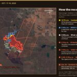 The storm line, then the fire: every satellite record of the CFB Wainwright fire, on one map
 DND said the Wainwright fire “ignited” at 4 p.m. The military now says it was known for hours


[…] DND’s written statements that a fire “ignited” at about 4 p.m.; no detection on the 3:33 p.m. pass (weak, given cloud) […]