Category Military

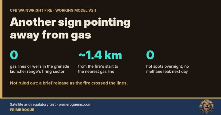
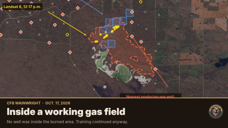
Another sign pointing away from gas: what satellites and the regulator show about CFB Wainwright’s gas lines

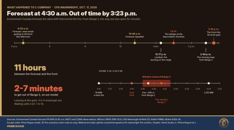
"Forecast at 4:30 a.m., out of time by 3:23 p.m.: CFB Wainwright fire timeline","Timeline: Environment Canada forecast the wind shift at 4:30 a.m.; in the Range 2 area, the escape window closed between about 3:18 and 3:23 p.m. on our model.","Environment Canada forecast the wind shift 11 hours ahead. On our model, troops in the Range 2 area had about two to seven minutes to get out. Graphic: Kevin Duska Jr. (Prime Rogue Inc.), CC BY-NC 4.0.","Timeline of Oct. 17, 2026 at CFB Wainwright: 4:30 a.m. forecast of west winds gusting to 80 km/h; 12:17 p.m. Landsat detection; Extreme fire danger; 2:49 p.m. fire moving away from Range 2; 3:16 p.m. 82 km/h gust; modelled escape window closing 3:18-3:23 p.m.; fire reaching Range 2 about 3:21 p.m. Sources: ECCC, NRCan CWFIS, NASA FIRMS, NOAA GOES-18.",CFB Wainwright fire; CFB Wainwright; C Company; 3rd Battalion PPCLI; Canadian Armed Forces; Department of National Defence; Alberta wildfire; OSINT; Authentic Stoic Stress Test; Prime Rogue; wind shift; forecast; timeline; escape window

Another sign pointing away from gas: what satellites and the regulator show about CFB Wainwright’s gas lines Kevin J.S. Duska Jr. · Prime Rogue · Calgary, AB · Oct. 24, 2026 CFB Wainwright Working model v2.1 The night of the…
What Happened to C Company: How a Forecast Wind Shift Trapped Soldiers at CFB Wainwright

Timeline: Environment Canada forecast the wind shift at 4:30 a.m.; in the Range 2 area, the escape window closed between about 3:18 and 3:23 p.m. on our model.

What Happened to C Company: How a Forecast Wind Shift Trapped Soldiers at CFB Wainwright Kevin J.S. Duska Jr. & Margot Lanihin | Prime Rogue Inc | Calgary, AB | October 22, 2026 Six public tests of our analysis, one…
How we found the 82 km/h CFB Wainwright gust: a step-by-step guide to Environment Canada’s wind data

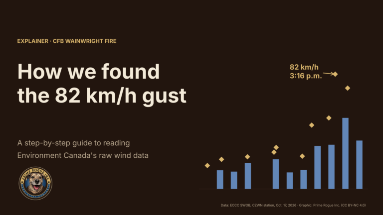
Header graphic reading "How we found the 82 km/h gust: a step-by-step guide to reading Environment Canada's raw wind data," beside a bar chart of hourly wind at the CFB Wainwright weather station with the 82 km/h gust at 3:16 p.m. marked in gold.

How we found the CFB Wainwright 82 km/h gust: a step-by-step guide to Environment Canada’s wind data Kevin J.S. Duska Jr. | Prime Rogue Inc | Calgary, AB | October 21, 2026 The strongest wind recorded near the CFB Wainwright…
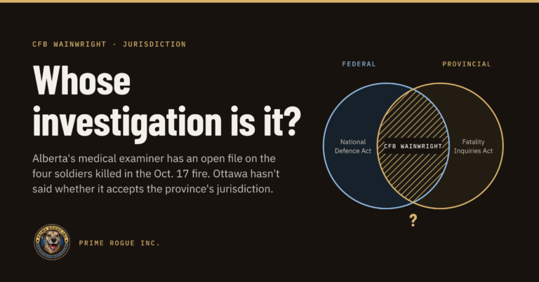
CFB Wainwright Deaths: Alberta Says Its Medical Examiner’s Investigation is Separate from Military’s

Headline graphic reading “Whose investigation is it?” Beside it are two overlapping circles, one labelled Federal (National Defence Act) and one labelled Provincial (Fatality Inquiries Act), with CFB Wainwright in the overlap.

CFB Wainwright deaths: Alberta says its medical examiner’s investigation is separate from the military’s Kevin Duska | Prime Rogue Inc | Calgary, AB | Oct 21, 2026 Update, Oct. 21, 2026: This story has been updated with a provincial official’s…
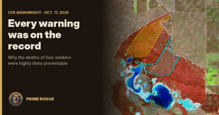
Every Warning Was On The Record: The CFB Wainwright Deaths Were Highly Likely Preventable

A satellite image of the burn scar at CFB Wainwright, with the fire before 3:16 p.m. outlined in yellow and the most likely area of the overrun outlined in teal, beside the title "Every warning was on the record."

Every Warning Was On The Record: The CFB Wainwright Deaths Were Highly Likely Preventable Kevin J.S. Duska Jr. | Prime Rogue Inc | Calgary, AB | October 21, 2026 The fire had burned for hours, the deadly wind was forecast…
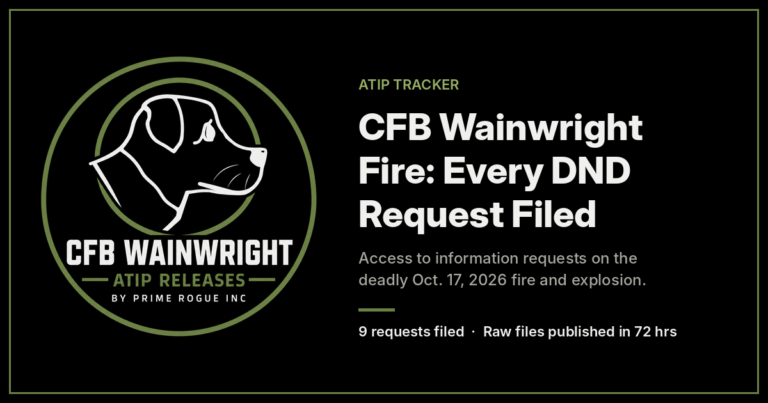
CFB Wainwright Fire: ATIP Request Tracker

Infographic listing nine access to information requests Prime Rogue Inc. filed with National Defence on the CFB Wainwright fire. It shows each request’s subject, request ID, filing date (October 18 or 20, 2026) and legal deadline (November 17 or 19, 2026). It also notes that most requests are expected to go to the Information Commissioner, and that releases will be published raw within 72 hours with checksummed, timestamped manifests. The full details are in the tracker on this page.

CFB Wainwright Fire: ATIP Request Tracker Prime Rogue is tracking every Access to Information request filed in connection with the deadly October 17, 2026 fire in the CFB Wainwright training area. This page is updated as requests are acknowledged, extended,…
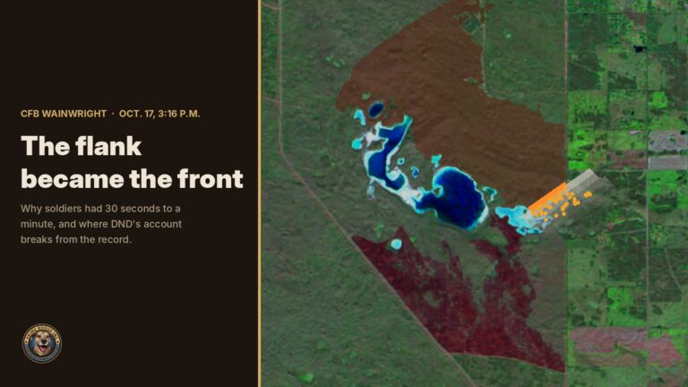
CFB Wainwright Fire: The Flank Became The Front

Title card reading "The flank became the front" beside a satellite map of CFB Wainwright, showing the burned area and an orange fire front advancing southeast with smoke ahead of it.

CFB Wainwright: The Flank Became the Front New satellite imagery shows a 2-km fire line turned into a wall of fire when a forecast cold front hit at CFB Wainwright. It explains how soldiers had 30 seconds to a minute,…
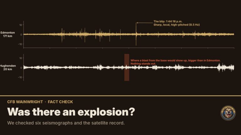
Gas wells played no part in the CFB Wainwright fire, records show

Satellite map of the CFB Wainwright fire area showing yellow fire detections and a red dashed burned area between two lakes, with red diamonds marking producing gas wells around it, under the headline "The fire and the gas wells."

Gas wells played no part in the CFB Wainwright fire, records show No well lies inside the area that burned on Oct. 17 at CFB Wainwright, and the provincial regulator says no operator has reported an incident. The well records…
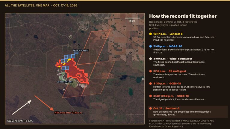
The storm line, then the fire: every satellite record of the CFB Wainwright fire, on one map

Map of the CFB Wainwright training area on a Sentinel-2 image from Oct. 4, with yellow Landsat 8 detections at 12:17 p.m., blue NOAA-20 pixels at 2:49 p.m., a large slanted GOES-18 pixel outline at 3:30 p.m., wind arrows turning from southwest to northwest, and a red burned area running southeast from the detections.

The storm line, then the fire: every satellite record of the CFB Wainwright fire, on one map NOAA’s weather satellite shows a line of storms crossing the training area minutes before an 82 km/h gust, and the fire flaring right…

Verified by MonsterInsights