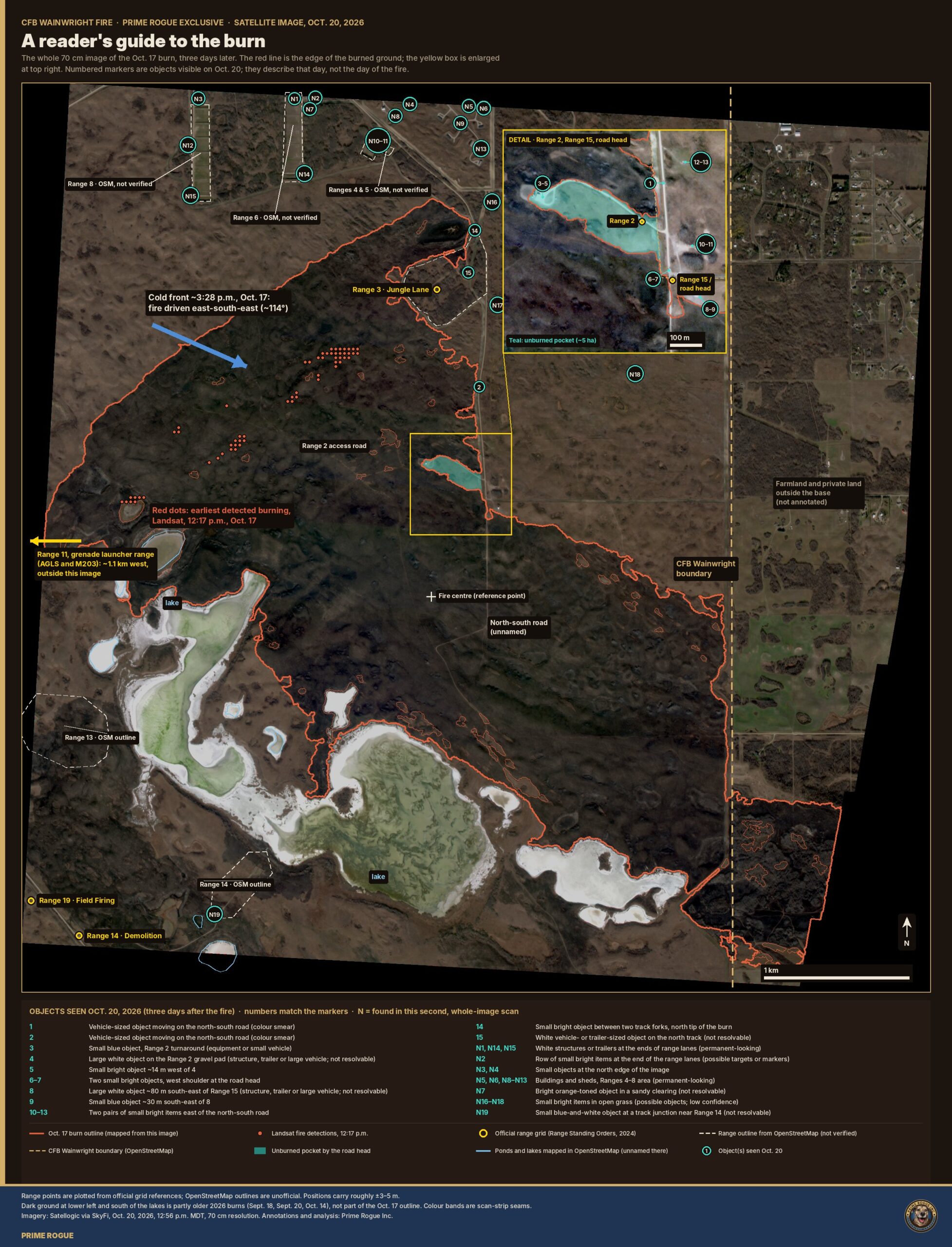
Our 70 cm satellite image of the Oct. 17 burn, labelled. It shows where the ranges are, where the fire was at 12:17 p.m., what didn’t burn, and what was on the ground three days later.
Introduction: A Reader’s guide to CFB Wainwright
Four soldiers died and dozens were hurt when fire swept part of CFB Wainwright on Oct. 17. Three days later, a Satellogic satellite photographed the burned ground at 70 cm resolution. Prime Rogue licensed that image.
This guide labels it: the burn’s edge, the official range locations, the roads, the line where Landsat first saw fire at 12:17 p.m., and every vehicle, structure and object we could find on Oct. 20.
Everything here shows the ground as it was on Oct. 20, not on the day of the fire.
Image 1: Reader’s-guide base map
The Oct. 17 burn at CFB Wainwright, three days later, with the ranges, roads and objects seen on Oct. 20 marked. Imagery: Satellogic via SkyFi, Oct. 20, 2026, 12:56 p.m. MDT, 70 cm resolution. Annotations and analysis: Prime Rogue Inc.
What you’re looking at
The dark ground inside the red line is what burned on Oct. 17: about 1,050 hectares inside this image.
The red dots near the top left are where Landsat detected fire at 12:17 p.m., about three hours before a cold front arrived around 3:28 p.m. and drove the fire east-south-east. The yellow box enlarges the area around Range 2, Range 15 and the road head.
Numbered markers are objects we could see on Oct. 20. None of them is inside the burn, and none can be identified at this resolution.
Yellow rings are the range locations given in the base’s own Range Standing Orders (2024 edition).
Dashed cream outlines are ranges as volunteers mapped them in OpenStreetMap. Some of those sit hundreds of metres from the official spots.
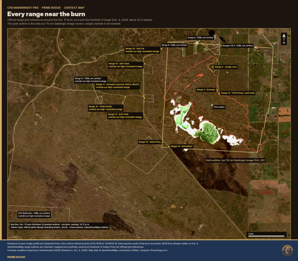
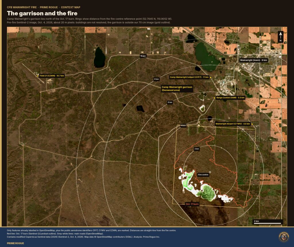
Ranges 10, 11, 13, 20, 21 and 22 lie west of our high-resolution image, including Range 11, the grenade launcher range. The background is a pre-fire image from Oct. 4.
CFB Wainwright Ranges: Close-Up Views
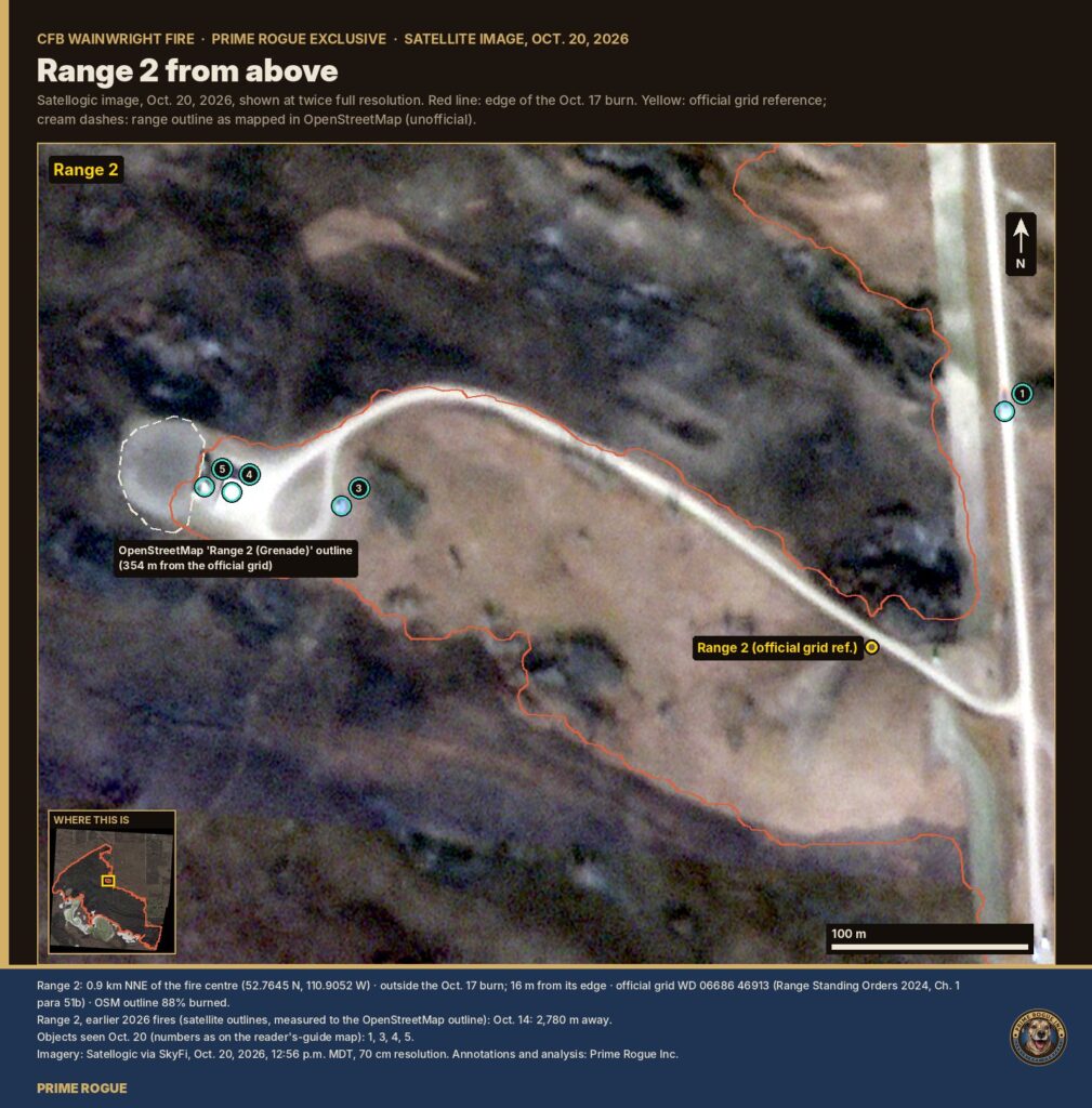
Range 2
Range 2, the Grenade Range, on Oct. 20. The official grid sits in unburned grass 16 m from the burn’s edge. Imagery: Satellogic via SkyFi, Oct. 20, 2026, 12:56 p.m. MDT, 70 cm resolution. Annotations and analysis: Prime Rogue Inc.
What you’re looking at:
The fire burned up to the north side of the Range 2 access road but left a pocket of about 5 ha south of it, where the official grid reference falls. The gravel pad at the road’s west end had a large white object on it on Oct. 20, with two smaller objects nearby. OpenStreetMap puts “Range 2” around that pad, 354 m from the official location.
Range 3
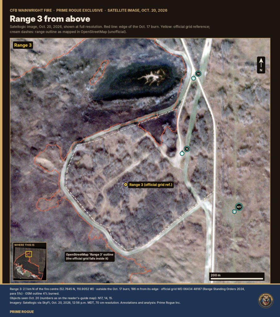
Range 3, the Jungle Lane, sits just outside the north tip of the burn. Imagery: Satellogic via SkyFi, Oct. 20, 2026, 12:56 p.m. MDT, 70 cm resolution. Annotations and analysis: Prime Rogue Inc.
What you’re looking at:
The official grid is about 200 m from the burn’s edge. The fire touched only a sliver of the mapped range outline, at its north-west corner. The very dark area at top is a low, wet spot that burned to black ash.
Ranges 4 and 5
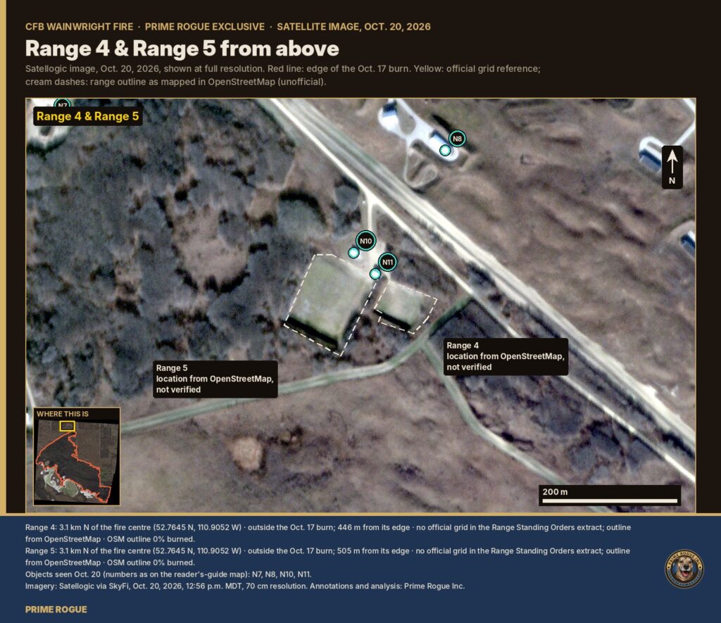
Ranges 4 and 5 as mapped in OpenStreetMap (locations not verified), about 450–500 m north of the burn. Imagery: Satellogic via SkyFi, Oct. 20, 2026, 12:56 p.m. MDT, 70 cm resolution. Annotations and analysis: Prime Rogue Inc.
What you’re looking at:
These two small ranges aren’t in our copy of the base’s range orders, so their outlines come from OpenStreetMap only. They’re well outside the burn. The buildings and sheds beside them look permanent.
Range 6
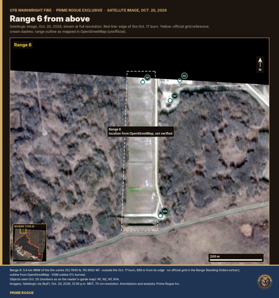
Range 6 as mapped in OpenStreetMap, about 900 m north of the burn. Imagery: Satellogic via SkyFi, Oct. 20, 2026, 12:56 p.m. MDT, 70 cm resolution. Annotations and analysis: Prime Rogue Inc.
What you’re looking at:
A long lane with structures at its north end, which our image cuts off. A row of small bright items there may be targets or markers. This range didn’t burn.
Range 8
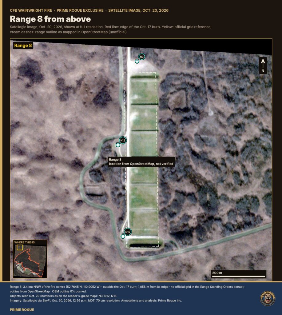
Range 8 as mapped in OpenStreetMap, about 1.1 km from the burn. Imagery: Satellogic via SkyFi, Oct. 20, 2026, 12:56 p.m. MDT, 70 cm resolution. Annotations and analysis: Prime Rogue Inc.
What you’re looking at:
Another long lane, with a small shed beside it and a white structure at the end of a loop road. It’s well clear of the burn.
Range 14
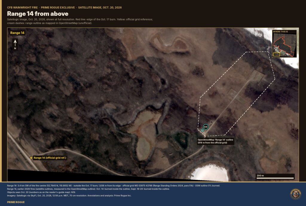
Range 14, the Demolition Range, at the south-west edge of our image. The dark ground here is mostly from earlier 2026 fires, not Oct. 17. Imagery: Satellogic via SkyFi, Oct. 20, 2026, 12:56 p.m. MDT, 70 cm resolution. Annotations and analysis: Prime Rogue Inc.
What you’re looking at:
The Oct. 17 burn ends about 1.8 km from Range 14’s official grid. Fires on Sept. 18–20 and Oct. 14 burned through the OpenStreetMap outline of the range, about 900 m from the official grid. A small blue-and-white object sat at a track junction there on Oct. 20.
Range 15
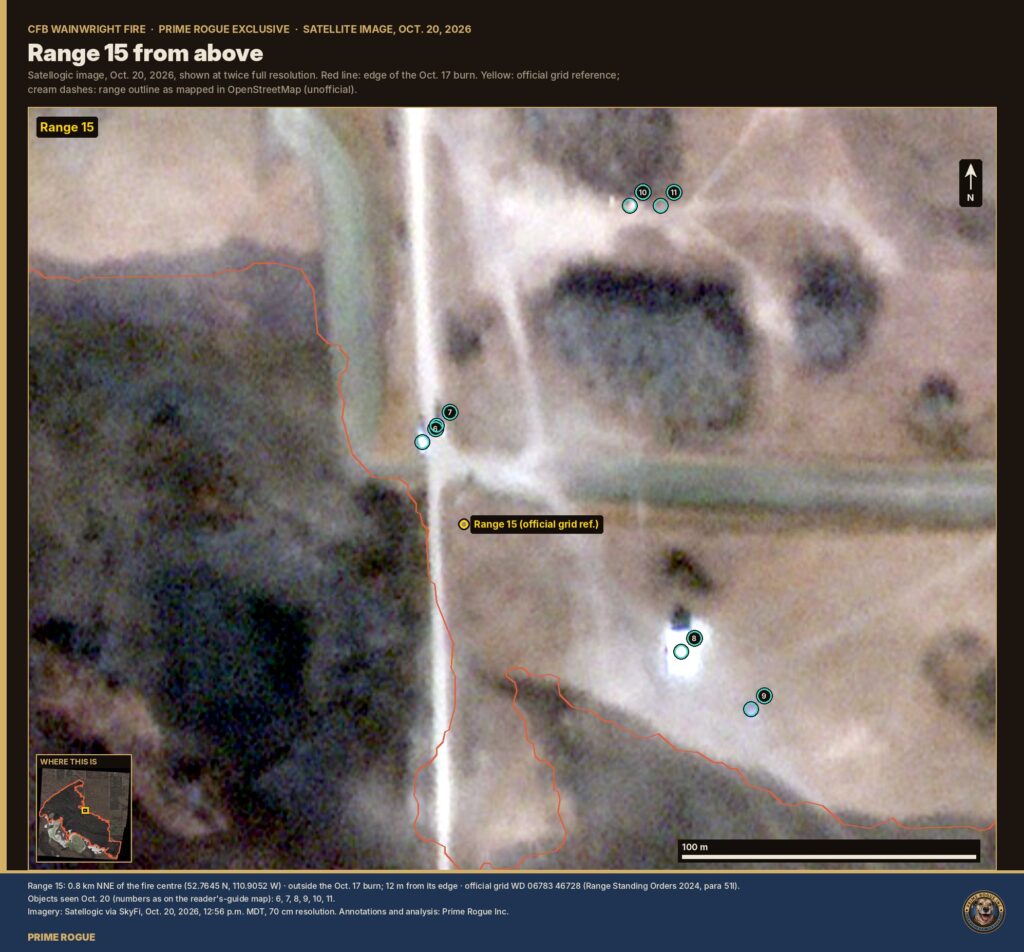
Range 15, a field firing range, at the road head, three days after the fire. Imagery: Satellogic via SkyFi, Oct. 20, 2026, 12:56 p.m. MDT, 70 cm resolution. Annotations and analysis: Prime Rogue Inc.
What you’re looking at:
Range 15’s official grid is at the junction where the east-west track meets the north-south road. The burn stops 12 m short of it. On Oct. 20 there were small objects on the road’s west shoulder, a large white object about 80 m south-east, and pairs of small items to the north-east.
Range 19
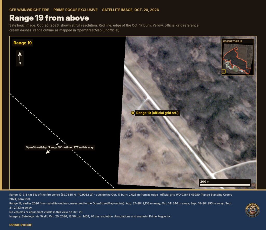
Range 19, a field firing range, sits right at the south-west edge of our image, about 2 km from the Oct. 17 burn. Imagery: Satellogic via SkyFi, Oct. 20, 2026, 12:56 p.m. MDT, 70 cm resolution. Annotations and analysis: Prime Rogue Inc.
What you’re looking at:
The black area is outside the image. Earlier 2026 fires came within about 300 m of Range 19’s mapped outline. We saw no vehicles or equipment in this view.
[…] recently in August), and will now intensify those efforts. In Syria, Iranian-backed units could fire rockets at the U.S. garrison at al-Tanf or other outposts, as well as escalate attacks on Israeli positions in the Golan […]
[…] records, the range safety radio net and the base weather station. Eleven days after the fire, the Department of National Defence has not said whether those records were preserved, or […]
[…] Department of National Defence (DND) has no known naval posture in the region. There are no operational plans for Lake Ontario […]
[…] or academic journals. Yet the digital age unleashed a tsunami of open data: social media posts, commercial satellite imagery, corporate records, online forums, and more. In conflicts and crises from the Arab Spring to the […]

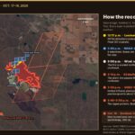 The storm line, then the fire: every satellite record of the CFB Wainwright fire, on one map
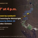 Every Warning Light Was On: What Most Likely Happened at CFB Wainwright
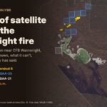 A week of satellite data on the CFB Wainwright fire: burning by 2:49 p.m., likely since morning
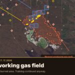 Gas wells played no part in the CFB Wainwright fire, records show


[…] recently in August), and will now intensify those efforts. In Syria, Iranian-backed units could fire rockets at the U.S. garrison at al-Tanf or other outposts, as well as escalate attacks on Israeli positions in the Golan […]
[…] records, the range safety radio net and the base weather station. Eleven days after the fire, the Department of National Defence has not said whether those records were preserved, or […]
[…] Department of National Defence (DND) has no known naval posture in the region. There are no operational plans for Lake Ontario […]
[…] or academic journals. Yet the digital age unleashed a tsunami of open data: social media posts, commercial satellite imagery, corporate records, online forums, and more. In conflicts and crises from the Arab Spring to the […]